
EXPEDITION TO EXPLORE SOME UNDOCUMENTED AREAS OF THE SEAFLOOR OFF THE WEST COAST
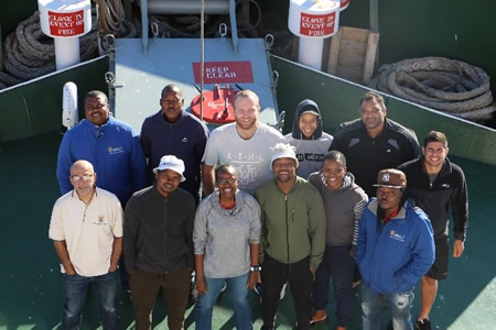
A department's team of scientists returned on the 28 March 2018 from a four-week long expedition to explore some undocumented areas of the seafloor off the West Coast. The seafloor has long been a mystery to humans, being as it is, covered by hundreds of metres (and sometimes kilometres) of water.
Alongside our spectacular canyons on land, South Africa also boasts such canyons in the deep ocean. Deep-sea underwater canyons, such as the Cape Canyon off the west coast of South Africa, are internationally classified as Vulnerable Marine Ecosystems (VME’s). These ecosystems are reported to potentially play a significant ecological role in the life history of some commercial resources (e.g. hake), and their unique structure connects the coastline to the deep-sea environment.
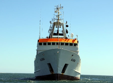
ON BOARD THE RESEARCH VESSEL (R/V) ALGOA
Apart from their ecological functions, the previously reported intensified upwelling events within submarine canyons may provide highly productive surface waters which in turn power feeding grounds for cetaceans and seabirds.
Although multi-disciplinary canyon research is an emergent field in South Africa, collaborative efforts have been initiated by the department's Oceans and Coast Branch, in order to document the potential ecological services the Cape Canyon may render.
In light of such a project, a team of researchers from the Chief Directorate: Oceans and Coast Research have just returned from a 25-day research expedition on board the Research Vessel (R/V) Algoa.
APPLYING AN ARRAY OF SHIP-BASED SAMPLING METHODS
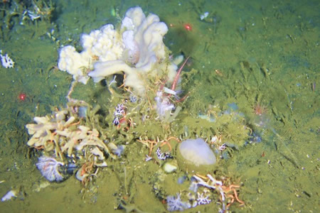
The sampling undertaken was designed to provide insights on the functionality of the Cape Canyon in relation to nearshore and offshore areas, and therefore different research components were investigated by applying an array of ship-based sampling methods. Sampling infrastructure include a tow-camera which takes images and videos of the seabed; a bottom sampler, known as a grab, collecting sediment (and invertebrates that live within the seabed) from the seafloor; a dredge which collects invertebrate animal samples from above the seabed; and a conductivity temperature depth (CTD) device that records information on the conductivity, temperature, salinity, and collects water samples to analyse environmental variables (such as nutrients, dissolved inorganic carbon and chlorophyll-a) at different depths throughout the water column.


Apart from these physical sampling approaches, an acoustic device which releases sound at different rates produced a map outlining the topography of the canyon. Cetacean and seabird observers also participated and provided information on the distribution and abundance of the different species recorded within the canyon. These data collected at the 55 camera stations, 65 dredge stations, 115 grab stations, 365 CTD stations as well as the cetacean and seabird observations will collectively provide answers to the project’s objective in characterising the area, and further complement the Marine Spatial Planning efforts within the department.